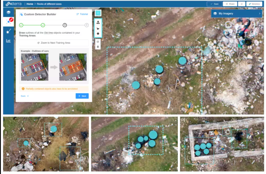

ImpactAlpha, September 19 – Swiss startup Picterra is helping city planners, farmers and humanitarian aid organizations take advantage of growing volumes of satellite and drone imagery. Picterra makes artificial intelligence-based software that can be “trained” to identify and map objects, like trees, homes or crops, in images.
It offers a free service that anyone can use and a premium service for professional users.
Impact investor Omidyar Network joined the company’s $3.3 million seed round for the software’s potential use in social and environmental impact initiatives, like aid delivery, crop and soil health tracking, and forest and wildlife monitoring.
“For geospatial technology to reach its full potential in promoting social good and impact, it cannot stay in the hands of a few. That’s why organizations that democratize industry data and expertise, like Picterra, are so vital,” Omidyar’s Peter Rabley said in a statement.
Omidyar invested in Picterra alongside space tech venture firm Space Capital, Berlin-based Atlantic Labs and another unnamed investor.